Map sources & licensing
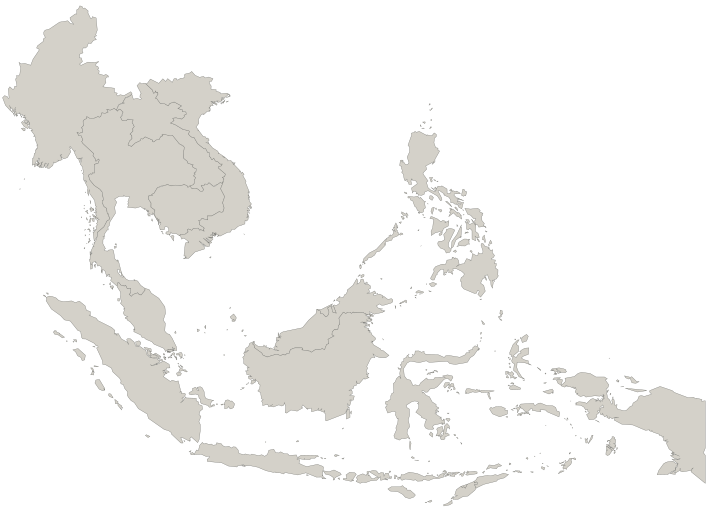
The mission map illustrates our ambition for Southeast Asia, not current customer reach or confirmed market coverage.
Singapore coastline
Contains information from geoBoundaries gbOpen SGP ADM0, sourced from Singapore’s Urban Redevelopment Authority and derived from Master Plan 2014 subzones (no sea), representing 2016.
The source dataset and our derived Singapore geometry are available under the Open Database License (ODbL) 1.0. Attribution for the geoBoundaries derivation is provided under Creative Commons Attribution 4.0.
For this map, coordinates were projected to an SVG viewbox, simplified at 0.008 SVG-unit tolerance and rounded to 0.001 SVG units. All 12 Singapore source polygons are retained.
- Download the original machine-readable GeoJSON
- Source metadata and license notice
- Full geoBoundaries attribution notice
- Download our machine-readable derived map geometry (SVG)
- Exact map-generation algorithm
geoBoundaries source revision: 9469f09592ced973a3448cf66b6100b741b64c0d.
Regional map
Country outlines for Myanmar, Thailand, Laos, Cambodia, Vietnam, Malaysia, Brunei, Indonesia, the Philippines and Timor-Leste come from Natural Earth 1:10 million Admin 0 Countries, a public-domain dataset.
Regional outlines were reprojected and simplified for display. Very small islets below 0.12 square SVG units are omitted. Larger islands and their holes are retained.
Globe
The land dots of the 3D globe on the landing page, and of the globe behind the site’s other pages, come from Natural Earth 1:50 million Admin 0 Countries, a public-domain dataset, as packaged in world-atlas 2.0.2 (ISC licence).
Countries were sampled onto rows of latitude for display; the orange spread shows our ambition, not current reach.
This is illustrative cartography, not authoritative boundary information or a current land-reclamation survey. Data providers do not endorse Invictus. Geographic-data licenses apply to the map data, not to Invictus branding, software or other site content.